1951 Map of Petersburg B-6
USGS Topo · Published 1975About this map
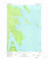
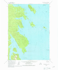
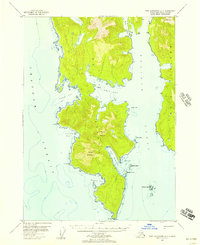
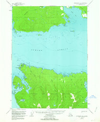
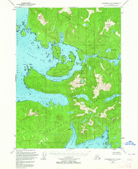
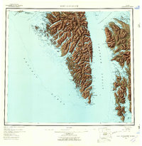
Kuiu Island and its intricate network of bays and straits are documented here following 1948 aerial photography and 1951 field annotation. The terrain is defined by the deep indentations of Alvin Bay and Reid Bay, leading south toward the waters of Port Beauclerc. This maritime landscape, entirely within the Tongass National Forest, centers on a cluster of islands in the Sumner Strait, including Conclusion Island and Sumner Island.
Find a feature on this map
21 named features on this map. Tap any name to fly to it.
Don’t see what you’re looking for? This feature index may not catch every label — zoom into the map to look around manually.
Map Details
Editions of this 1951 Petersburg B-6 Map
3 editions found

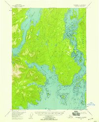
Other maps of this area

1948 · Port Alexander C-1
USGS Topo · 1:63,360

1948 · Petersburg A-6
USGS Topo · 1:63,360
1948 · Port Alexander A-1
USGS Topo · 1:63,360

1948 · Petersburg B-6
USGS Topo · 1:63,360

1948 · Port Alexander B-1
USGS Topo · 1:63,360
1948 · Petersburg C-6
USGS Topo · 1:63,360

1948 · Petersburg C-5
USGS Topo · 1:63,360
1949 · Petersburg B-5
USGS Topo · 1:63,360
1949 · Petersburg A-5
USGS Topo · 1:63,360
1951 · Port Alexander
USGS Topo · 1:250,000