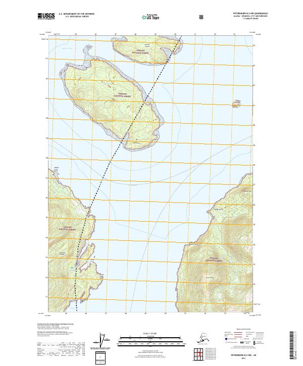
2021 Map of Petersburg B-2 NW
USGS Topo · Published 2021About this map
Sumner Strait defines the maritime character of this Southeast Alaska landscape, serving as a primary waterway between the islands of the Tongass National Forest. The map detail focuses on several distinct landmasses, most notably Vank Island and the northern reaches of Zarembo Island. Elevation is concentrated at Ancon Peak, which towers over the eastern shoreline near Elephants Nose. Navigational points such as Middle Craig Point and South Craig Point delineate the western coast, while the protected waters of Anita Bay and Deep Bay suggest natural harbors used by mariners and local industry. The distribution of small islets like Fivemile Island and Sokolof Island illustrates the complex archipelago geography typical of the Wrangell region, where deep water channels and high peaks meet.
Find a feature on this map
21 named features on this map. Tap any name to fly to it.
Don’t see what you’re looking for? This feature index may not catch every label — zoom into the map to look around manually.
Map Details
Editions of this 2021 Petersburg B-2 NW Map
This is the sole edition of this map. No revisions or reprints were ever made.
Other maps of this area

1948 · Petersburg C-2
USGS Topo · 1:63,360

1948 · Petersburg B-2
USGS Topo · 1:63,360

1948 · Petersburg C-3
USGS Topo · 1:63,360

1948 · Petersburg B-3
USGS Topo · 1:63,360

1951 · Petersburg B-3
USGS Topo · 1:63,360

1951 · Petersburg C-2
USGS Topo · 1:63,360

1952 · Petersburg
USGS Topo · 1:250,000

1953 · Petersburg B-2
USGS Topo · 1:63,360

1953 · Petersburg C-3
USGS Topo · 1:63,360

1960 · Petersburg
USGS Topo · 1:250,000