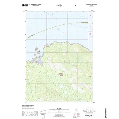
2017 Map of Petersburg B-3 NW
USGS Topo · Published 2017About this map
Saint John Harbor serves as a primary coastal feature on Zarembo Island, guarded by Northerly Island and Southerly Island within the Tongass National Forest. This 2017 survey details a landscape defined by its timber-access network and natural hydrology, from the interior Zarembo Lake to the marshy Zarembo Flats near the southern coast. The island's topography rises to St John Knob, while a series of named roads and trails like Muskeg Run, Skyline, and Eyeopener cut through the forest, indicating modern land management and recreation patterns. The boundary between Petersburg Borough and Wrangell Borough crosses the northern waters of Sumner Strait, reflecting the administrative divisions of this maritime environment along the Gulf of Alaska.
Find a feature on this map
20 named features on this map. Tap any name to fly to it.
Don’t see what you’re looking for? This feature index may not catch every label — zoom into the map to look around manually.
Map Details
Editions of this 2017 Petersburg B-3 NW Map
This is the sole edition of this map. No revisions or reprints were ever made.
Other maps of this area

1948 · Petersburg C-4
USGS Topo · 1:63,360

1948 · Petersburg C-3
USGS Topo · 1:63,360

1948 · Petersburg B-3
USGS Topo · 1:63,360

1949 · Petersburg B-4
USGS Topo · 1:63,360

1951 · Petersburg B-4
USGS Topo · 1:63,360

1951 · Petersburg B-3
USGS Topo · 1:63,360

1951 · Petersburg C-4
USGS Topo · 1:63,360

1952 · Petersburg
USGS Topo · 1:250,000

1953 · Petersburg C-3
USGS Topo · 1:63,360

1960 · Petersburg
USGS Topo · 1:250,000