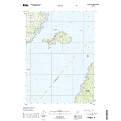
2017 Map of Petersburg B-4 NE
USGS Topo · Published 2017About this map
Level Islands sit at the center of this coastal survey, where the waters of the Gulf of Alaska meet the sheltered passage of Sumner Strait. These small landmasses, including Big Level Island and Little Level Island, are surrounded by navigational hazards such as White Rock and Vichnefski Rock. The map illustrates the complex shoreline of southeast Alaska's Alexander Archipelago, featuring the southern edge of Kupreanof Island and the northern tip of Zarembo Island.
Find a feature on this map
17 named features on this map. Tap any name to fly to it.
Don’t see what you’re looking for? This feature index may not catch every label — zoom into the map to look around manually.
Map Details
Editions of this 2017 Petersburg B-4 NE Map
This is the sole edition of this map. No revisions or reprints were ever made.
Other maps of this area

1948 · Petersburg C-4
USGS Topo · 1:63,360

1948 · Petersburg C-3
USGS Topo · 1:63,360

1948 · Petersburg B-3
USGS Topo · 1:63,360

1949 · Petersburg B-4
USGS Topo · 1:63,360

1951 · Petersburg B-4
USGS Topo · 1:63,360

1951 · Petersburg B-3
USGS Topo · 1:63,360

1951 · Petersburg C-4
USGS Topo · 1:63,360

1952 · Petersburg
USGS Topo · 1:250,000

1953 · Petersburg C-3
USGS Topo · 1:63,360

1960 · Petersburg
USGS Topo · 1:250,000