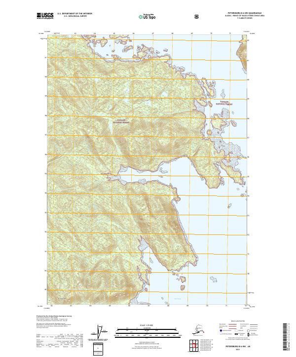
2021 Map of Petersburg B-6 NW
USGS Topo · Published 2021About this map
Kuiu Island provides the backdrop for this coastal study within the Tongass National Forest, illustrating a landscape defined by intricate shorelines and dramatic topography. The map details a series of deep water inlets, most notably the central carving of Alvin Bay, which nearly bisects this portion of the island. To the north, No Name Bay marks the coastal fringe, while Reid Bay sits at the southern edge of the sheet. The terrain is characterized by steep elevation changes, with the interior heights of the forest reaching down to the jagged tide-water edges. This 2021 update from the U.S. Geological Survey focuses on the natural hydrography and forestry boundaries of Southeast Alaska, capturing a wilderness area largely devoid of modern development or road networks.
Find a feature on this map
9 named features on this map. Tap any name to fly to it.
Don’t see what you’re looking for? This feature index may not catch every label — zoom into the map to look around manually.
Map Details
Editions of this 2021 Petersburg B-6 NW Map
This is the sole edition of this map. No revisions or reprints were ever made.
Other maps of this area

1948 · Port Alexander C-1
USGS Topo · 1:63,360

1948 · Petersburg B-6
USGS Topo · 1:63,360

1948 · Port Alexander B-1
USGS Topo · 1:63,360

1948 · Petersburg C-6
USGS Topo · 1:63,360

1951 · Port Alexander
USGS Topo · 1:250,000

1951 · Port Alexander C-1
USGS Topo · 1:63,360

1951 · Petersburg B-6
USGS Topo · 1:63,360

1952 · Petersburg
USGS Topo · 1:250,000

1952 · Port Alexander
USGS Topo · 1:250,000
1953 · Port Alexander B-1
USGS Topo · 1:63,360