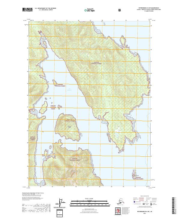
2021 Map of Petersburg B-6 SW
USGS Topo · Published 2021About this map
Port Beauclerc defines the coastal geography of this island landscape, where deep inlets and protected waterways are sheltered by timbered terrain. Most of the land falls within the Tongass National Forest, illustrating a preserved wilderness of the Alexander Archipelago. Prominent landmarks such as Edwards Island and the isolated Beauclerc Island to the southeast punctuate the maritime approaches. Inland, the topography rises sharply toward Beauclerc Peak, which serves as a significant high point for navigators and surveyors. This map captures the intersection of coastal marine environments and the high-elevation slopes of the southern Alaskan islands, showing a landscape defined by its glacial carving and dense maritime forest cover.
Find a feature on this map
11 named features on this map. Tap any name to fly to it.
Don’t see what you’re looking for? This feature index may not catch every label — zoom into the map to look around manually.
Map Details
Editions of this 2021 Petersburg B-6 SW Map
This is the sole edition of this map. No revisions or reprints were ever made.
Other maps of this area

1948 · Petersburg A-6
USGS Topo · 1:63,360

1948 · Port Alexander A-1
USGS Topo · 1:63,360

1948 · Petersburg B-6
USGS Topo · 1:63,360

1948 · Port Alexander B-1
USGS Topo · 1:63,360

1951 · Port Alexander
USGS Topo · 1:250,000

1951 · Petersburg B-6
USGS Topo · 1:63,360

1951 · Petersburg A-6
USGS Topo · 1:63,360

1952 · Petersburg
USGS Topo · 1:250,000

1952 · Port Alexander
USGS Topo · 1:250,000
1953 · Port Alexander B-1
USGS Topo · 1:63,360