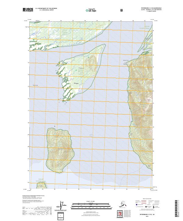
2024 Map of Petersburg C-2 SE
USGS Topo · Published 2024About this map
Sergief Island and Kadin Island sit at the confluence of glacial waters and coastal passages within the sprawling Tongass National Forest. This mapping of the Wrangell vicinity highlights a landscape of shifting silt and sharp relief, where the Koknuk Flats meet the tidal reach of Binkley Slough. The area is characterized by the massive protected expanse of the Stikine-LeConte Wilderness, which encompasses both the coastal lowlands and the steep elevations of Garnet Mtn.
Find a feature on this map
23 named features on this map. Tap any name to fly to it.
Don’t see what you’re looking for? This feature index may not catch every label — zoom into the map to look around manually.
Map Details
Editions of this 2024 Petersburg C-2 SE Map
This is the sole edition of this map. No revisions or reprints were ever made.
Other maps of this area

1948 · Petersburg C-1
USGS Topo · 1:63,360

1948 · Petersburg C-2
USGS Topo · 1:63,360

1948 · Petersburg B-2
USGS Topo · 1:63,360

1948 · Petersburg B-1
USGS Topo · 1:63,360

1951 · Petersburg C-2
USGS Topo · 1:63,360

1952 · Petersburg
USGS Topo · 1:250,000

1953 · Petersburg C-1
USGS Topo · 1:63,360

1953 · Petersburg B-2
USGS Topo · 1:63,360

1955 · Petersburg B-1
USGS Topo · 1:63,360

1960 · Petersburg
USGS Topo · 1:250,000