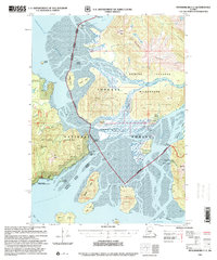
1997 Map of Petersburg C-2
USGS Topo · Published 2000About this map
Stikine River and its complex network of sloughs define this portion of the Tongass National Forest, where the delta's shifting silt creates the expansive Koknuk Flats. The landscape is a mix of high alpine terrain, such as Wilkes Peak and Manzanita Peak, and low-lying estuarine islands like Dry Island and Farm Island. This 1997 revision highlights the importance of the Forest Service cabin system for navigation and shelter in the wilderness, featuring sites like Garnet Ledge Cabin (FS) and Sergief Island Cabin (FS).
Find a feature on this map
61 named features on this map. Tap any name to fly to it.
Don’t see what you’re looking for? This feature index may not catch every label — zoom into the map to look around manually.
Map Details
Editions of this 1997 Petersburg C-2 Map
This is the sole edition of this map. No revisions or reprints were ever made.
Other maps of this area

1948 · Petersburg C-1
USGS Topo · 1:63,360

1948 · Petersburg C-2
USGS Topo · 1:63,360

1948 · Petersburg B-2
USGS Topo · 1:63,360

1948 · Petersburg B-1
USGS Topo · 1:63,360

1948 · Petersburg C-3
USGS Topo · 1:63,360

1948 · Petersburg B-3
USGS Topo · 1:63,360

1951 · Petersburg B-3
USGS Topo · 1:63,360

1951 · Petersburg C-2
USGS Topo · 1:63,360

1952 · Petersburg
USGS Topo · 1:250,000

1953 · Petersburg C-1
USGS Topo · 1:63,360