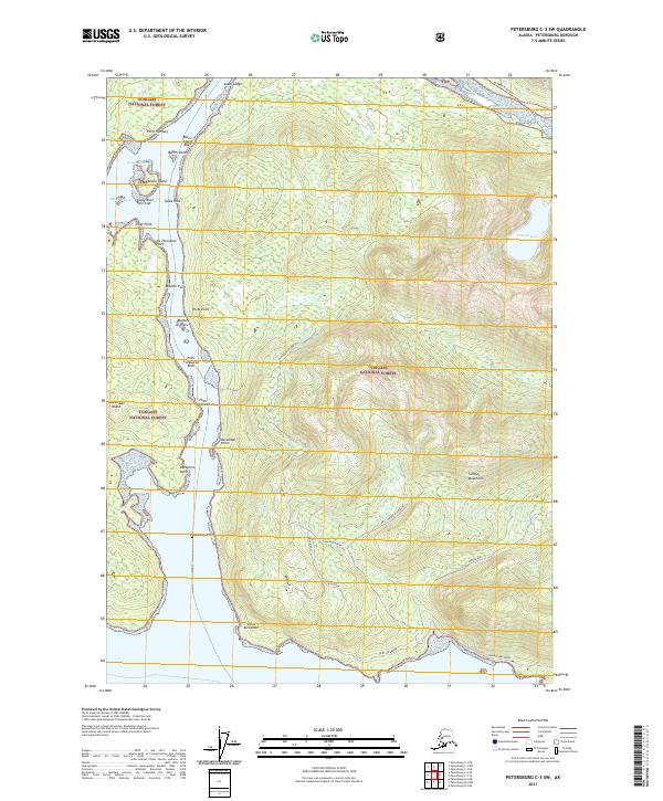
2021 Map of Petersburg C-3 SW
USGS Topo · Published 2021About this map
Tongass National Forest dominates this coastal Alaskan landscape, where the interplay of tide and timber defines the geography. Navigational points such as Point Alexander and Point Lockwood trace the intricate shoreline of the Keene Channel and Beecher Pass. The terrain is characterized by steep rises toward the Sumner Mountains and West Sumner Mountains, interspersed with interior features like Crystal Lake. Access into these forested highlands is facilitated by Woodpecker Road and the Mitkof Highway, providing a modern look at the land-use patterns in this part of the Petersburg Borough. From the Battery Islets to the southern tip at Point Alexander, the map details a region where the maritime and mountain environments meet.
Find a feature on this map
38 named features on this map. Tap any name to fly to it.
Don’t see what you’re looking for? This feature index may not catch every label — zoom into the map to look around manually.
Map Details
Editions of this 2021 Petersburg C-3 SW Map
This is the sole edition of this map. No revisions or reprints were ever made.
Other maps of this area

1948 · Petersburg C-4
USGS Topo · 1:63,360

1948 · Petersburg C-3
USGS Topo · 1:63,360

1948 · Petersburg B-3
USGS Topo · 1:63,360

1949 · Petersburg B-4
USGS Topo · 1:63,360

1951 · Petersburg B-4
USGS Topo · 1:63,360

1951 · Petersburg B-3
USGS Topo · 1:63,360

1951 · Petersburg C-4
USGS Topo · 1:63,360

1952 · Petersburg
USGS Topo · 1:250,000

1953 · Petersburg C-3
USGS Topo · 1:63,360

1960 · Petersburg
USGS Topo · 1:250,000