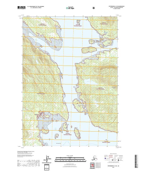
2021 Map of Petersburg C-4 SE
USGS Topo · Published 2021About this map
Tongass National Forest dominates this Alaskan landscape, where a complex network of islands and passages defines the coastal geography. The map focuses on the waters of Beecher Pass and Little Duncan Bay, surrounding prominent landmasses such as Woewodski Island and Big Saltery Island. The intricate shoreline is dotted with smaller features like Emily Island, Christmas Island, and Blowdown Island, reflecting the dynamic maritime environment of the Alexander Archipelago. Inland, the terrain is punctuated by freshwater bodies including Harvey Lake and Harrys Lake, which are accessible via established routes like the Harvey Lake Trl. The presence of the Kah Sheets Lake Trl leading toward Kah Sheets Bay suggests the importance of these waterways for both travel and natural resource access in this heavily forested region.
Find a feature on this map
32 named features on this map. Tap any name to fly to it.
Don’t see what you’re looking for? This feature index may not catch every label — zoom into the map to look around manually.
Map Details
Editions of this 2021 Petersburg C-4 SE Map
This is the sole edition of this map. No revisions or reprints were ever made.
Other maps of this area

1948 · Petersburg C-4
USGS Topo · 1:63,360

1948 · Petersburg C-3
USGS Topo · 1:63,360

1948 · Petersburg B-3
USGS Topo · 1:63,360

1949 · Petersburg B-4
USGS Topo · 1:63,360

1951 · Petersburg B-4
USGS Topo · 1:63,360

1951 · Petersburg B-3
USGS Topo · 1:63,360

1951 · Petersburg C-4
USGS Topo · 1:63,360

1952 · Petersburg
USGS Topo · 1:250,000

1953 · Petersburg C-3
USGS Topo · 1:63,360

1960 · Petersburg
USGS Topo · 1:250,000