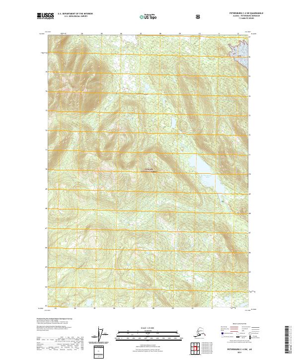
2021 Map of Petersburg C-4 SW
USGS Topo · Published 2021About this map
Kupreanof Island defines the heart of this coastal wilderness, covered by the dense woodlands of the Tongass National Forest. The landscape is dominated by a high-elevation interior where Middle Cr and Kah Sheets Cr drain through steep glacial valleys. Toward the east, the terrain levels into the basin of Kah Sheets Lake, a significant freshwater feature connected to the coast via the Kah Sheets Lake Trl. This trail provides one of the few established routes through the timbered slopes, reflecting the area's isolation and reliance on traditional paths for navigation. The map's detail shows a network of township and range lines, including t61s r78e, which overlay the natural topography with a surveyor's precision during this early 21st-century study.
Find a feature on this map
12 named features on this map. Tap any name to fly to it.
Don’t see what you’re looking for? This feature index may not catch every label — zoom into the map to look around manually.
Map Details
Editions of this 2021 Petersburg C-4 SW Map
This is the sole edition of this map. No revisions or reprints were ever made.
Other maps of this area

1948 · Petersburg C-4
USGS Topo · 1:63,360

1948 · Petersburg C-5
USGS Topo · 1:63,360

1949 · Petersburg B-5
USGS Topo · 1:63,360

1949 · Petersburg B-4
USGS Topo · 1:63,360

1951 · Petersburg B-4
USGS Topo · 1:63,360

1951 · Petersburg C-4
USGS Topo · 1:63,360

1951 · Petersburg C-5
USGS Topo · 1:63,360

1952 · Petersburg
USGS Topo · 1:250,000
1953 · Petersburg B-5
USGS Topo · 1:63,360

1960 · Petersburg
USGS Topo · 1:250,000