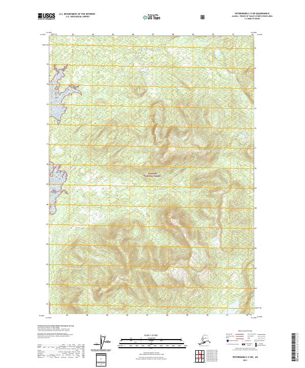
2021 Map of Petersburg C-5 SW
USGS Topo · Published 2021About this map
Tongass National Forest dominates the landscape of this coastal Alaskan territory, representing a wilderness defined by its intricate drainage systems and high-elevation contours. The map documents the winding path of Tunehean Creek (also labeled as Tunehean Cr) as it flows through the northern reaches of the quadrangle. In the southern interior, Lovelace Cr carves through the terrain, while Kushneahin Lake sits in a topographic depression near the southeastern corner. This area, structured by the Public Land Survey System townships of t60s r75e and t61s r76e, shows a pristine environment with no marked roads or settlements, reflecting the remote character of the Alexander Archipelago's interior forest lands in the early 2020s.
Find a feature on this map
11 named features on this map. Tap any name to fly to it.
Don’t see what you’re looking for? This feature index may not catch every label — zoom into the map to look around manually.
Map Details
Editions of this 2021 Petersburg C-5 SW Map
This is the sole edition of this map. No revisions or reprints were ever made.
Other maps of this area

1948 · Petersburg B-6
USGS Topo · 1:63,360

1948 · Petersburg C-6
USGS Topo · 1:63,360

1948 · Petersburg C-5
USGS Topo · 1:63,360

1949 · Petersburg B-5
USGS Topo · 1:63,360

1951 · Petersburg C-5
USGS Topo · 1:63,360

1951 · Petersburg B-6
USGS Topo · 1:63,360

1952 · Petersburg
USGS Topo · 1:250,000
1953 · Petersburg B-5
USGS Topo · 1:63,360

1960 · Petersburg
USGS Topo · 1:250,000
1995 · Petersburg B-5
USGS Topo · 1:63,360