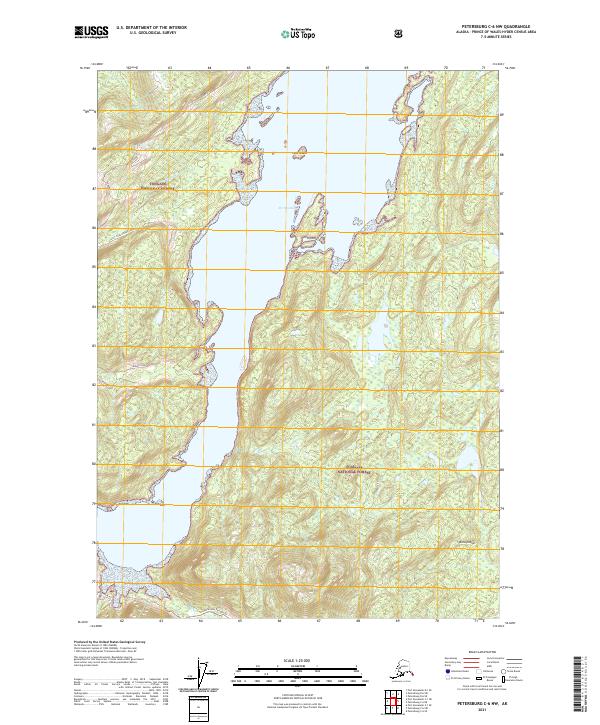
2021 Map of Petersburg C-6 NW
USGS Topo · Published 2021About this map
Port Camden dominates this coastal survey of Kuiu Island within the Tongass National Forest. The landscape is defined by the deep indentation of the port, which nearly bisects the landmass, connected only by the Threemile Arm Portage Trl at the southern reach. This portage route reflects the historical necessity of navigating the complex Alexander Archipelago shoreline. Evidence of forest management and access is found in naming conventions like the Kuiu Mainline and various logging or service roads such as Hobnail and Hokum. The map details a network of drainage systems including East Fork Kadake Creek and Mud Cr, while smaller features like Corn Island and the Beaver Pond provide specific landmarks for local navigation and terrain study.
Find a feature on this map
17 named features on this map. Tap any name to fly to it.
Don’t see what you’re looking for? This feature index may not catch every label — zoom into the map to look around manually.
Map Details
Editions of this 2021 Petersburg C-6 NW Map
This is the sole edition of this map. No revisions or reprints were ever made.
Other maps of this area

1948 · Port Alexander C-1
USGS Topo · 1:63,360

1948 · Petersburg D-6
USGS Topo · 1:63,360

1948 · Port Alexander D-1
USGS Topo · 1:63,360

1948 · Petersburg C-6
USGS Topo · 1:63,360

1951 · Port Alexander
USGS Topo · 1:250,000

1951 · Petersburg D-6
USGS Topo · 1:63,360

1951 · Port Alexander C-1
USGS Topo · 1:63,360

1952 · Petersburg
USGS Topo · 1:250,000

1952 · Port Alexander
USGS Topo · 1:250,000

1960 · Petersburg
USGS Topo · 1:250,000