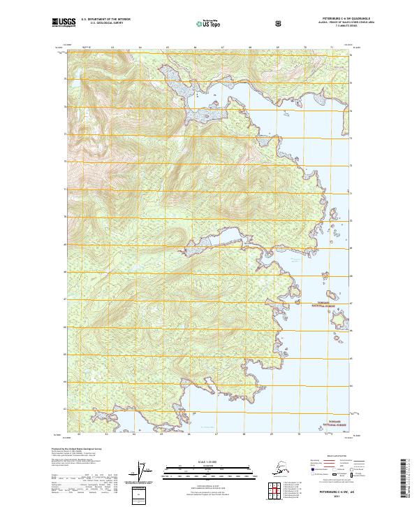
2021 Map of Petersburg C-6 SW
USGS Topo · Published 2021About this map
Tongass National Forest defines the coastal character of this Kuiu Island landscape, where intricate shorelines and tidal inlets dominate the geography. The map tracks the vital transportation corridors of the region, including the Kuiu Mainline and the Threemile Arm Portage Trl, which connect deep-water access points like Seclusion Harbor and No Name Bay. This 2021 survey illustrates the reliance on maritime and forest service infrastructure in the Alexander Archipelago, showing how natural features like Eagle Island and the reaches of Upper 3-Mile Arm frame the navigable waterways essential for local transit and timber management.
Find a feature on this map
15 named features on this map. Tap any name to fly to it.
Don’t see what you’re looking for? This feature index may not catch every label — zoom into the map to look around manually.
Map Details
Editions of this 2021 Petersburg C-6 SW Map
This is the sole edition of this map. No revisions or reprints were ever made.
Other maps of this area

1948 · Port Alexander C-1
USGS Topo · 1:63,360

1948 · Petersburg B-6
USGS Topo · 1:63,360

1948 · Port Alexander B-1
USGS Topo · 1:63,360

1948 · Petersburg C-6
USGS Topo · 1:63,360

1951 · Port Alexander
USGS Topo · 1:250,000

1951 · Port Alexander C-1
USGS Topo · 1:63,360

1951 · Petersburg B-6
USGS Topo · 1:63,360

1952 · Petersburg
USGS Topo · 1:250,000

1952 · Port Alexander
USGS Topo · 1:250,000
1953 · Port Alexander B-1
USGS Topo · 1:63,360