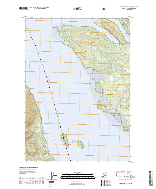
2024 Map of Petersburg D-3 NW
USGS Topo · Published 2024About this map
The Point Agassiz Peninsula dominates this coastal survey, where the rugged shoreline meets the waters of Southeast Alaska. This 2024 map documents the maritime geography and federal land management within the Tongass National Forest, illustrating a landscape defined by dramatic points and sheltered inlets. From the northern reaches at Thomas Bay and Wood Point down to the southern Sukoi Islets, the terrain transition from sea level to significant elevations is marked by precise contour intervals. Significant navigational landmarks like Beacon Point and Prolewy Rocks line the waterway, providing a detailed look at the hazardous coastal features that have long guided local mariners. The southern portion of the sheet is drained by Fivemile Creek, showing the drainage patterns typical of this temperate rainforest environment.
Find a feature on this map
15 named features on this map. Tap any name to fly to it.
Don’t see what you’re looking for? This feature index may not catch every label — zoom into the map to look around manually.
Map Details
Editions of this 2024 Petersburg D-3 NW Map
This is the sole edition of this map. No revisions or reprints were ever made.
Other maps of this area

1948 · Sumdum A-4
USGS Topo · 1:63,360

1951 · Petersburg D-4
USGS Topo · 1:63,360

1951 · Sumdum A-4
USGS Topo · 1:63,360

1952 · Petersburg
USGS Topo · 1:250,000

1952 · Sumdum
USGS Topo · 1:250,000

1960 · Petersburg
USGS Topo · 1:250,000

1961 · Petersburg D-3
USGS Topo · 1:63,360

1961 · Sumdum A-3
USGS Topo · 1:63,360

1961 · Sumdum
USGS Topo · 1:250,000
1992 · Petersburg D-4 SE
USGS Topo · 1:25,000