
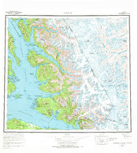
1961 Map of Sumdum
USGS Topo · Published 1967About this map
Tongass National Forest dominates this coastal survey, where the intricate maritime landscape of Southeast Alaska meets the international boundary with Canada. Small settlements like Windham and Sylvia sit along the deep inlets of Windham Bay, while industrial traces appear at a Mine and the Salt Chuck. The maritime importance of these waters is evidenced by the Lighthouse Reserve and the Five Finger Lighthouse positioned within Stephens Passage.
Find a feature on this map
174 named features on this map. Tap any name to fly to it.
Don’t see what you’re looking for? This feature index may not catch every label — zoom into the map to look around manually.
Map Details
Editions of this 1961 Sumdum Map
2 editions found
Other maps of this area

1943 · Sumdum B-4
USGS Topo · 1:63,360

1948 · Sitka D-1
USGS Topo · 1:63,360

1948 · Sitka B-1
USGS Topo · 1:63,360

1948 · Sumdum A-4
USGS Topo · 1:63,360

1948 · Sitka C-1
USGS Topo · 1:63,360

1948 · Sumdum D-6
USGS Topo · 1:63,360

1948 · Sumdum A-5
USGS Topo · 1:63,360

1948 · Sumdum C-5
USGS Topo · 1:63,360

1948 · Sumdum A-6
USGS Topo · 1:63,360

1948 · Sumdum B-6
USGS Topo · 1:63,360