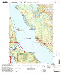
1995 Map of Petersburg D-3
USGS Topo · Published 1995About this map
Wrangell Narrows separates the settlements of Petersburg on Mitkof Island from the small enclave of Kupreanof across the water. This 1995 revision by the Forest Service highlights a maritime landscape where the Alaska Marine Highway serves as the primary artery for travel and commerce. The map records the local infrastructure of the mid-1990s, including the Petersburg Airport, a local Cem, and a Log Transfer Facility north on the Agassiz Peninsula.
Find a feature on this map
57 named features on this map. Tap any name to fly to it.
Don’t see what you’re looking for? This feature index may not catch every label — zoom into the map to look around manually.
Map Details
Editions of this 1995 Petersburg D-3 Map
This is the sole edition of this map. No revisions or reprints were ever made.
Other maps of this area

1948 · Sumdum A-4
USGS Topo · 1:63,360

1948 · Petersburg C-4
USGS Topo · 1:63,360

1948 · Petersburg C-2
USGS Topo · 1:63,360

1948 · Petersburg C-3
USGS Topo · 1:63,360

1951 · Petersburg D-4
USGS Topo · 1:63,360

1951 · Petersburg C-4
USGS Topo · 1:63,360

1951 · Sumdum A-4
USGS Topo · 1:63,360

1951 · Petersburg C-2
USGS Topo · 1:63,360

1952 · Petersburg
USGS Topo · 1:250,000

1952 · Sumdum
USGS Topo · 1:250,000