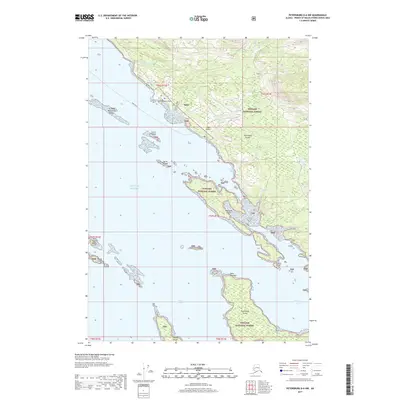
2017 Map of Petersburg D-6 NW
USGS Topo · Published 2017About this map
The village of Kake on Kupreanof Island serves as the central hub of this 2017 topographic survey. Situated within the Tongass National Forest, the region is defined by its intricate network of waterways, including the Keku Strait, Portage Bay, and Hamilton Bay. This map documents the coastal infrastructure near the community, featuring the Kake Airport and the Kake Seaplane Base. Inland, the landscape is crisscrossed by several drainages such as Gunnuk Cr, Little Gunnuk Cr, and Slo Duc Cr. Maritime history and local geography are highlighted by the presence of Grave Island, while the Keku Islands, Kousk Island, and Hound Island dot the surrounding waters of the Gulf of Alaska.
Find a feature on this map
34 named features on this map. Tap any name to fly to it.
Don’t see what you’re looking for? This feature index may not catch every label — zoom into the map to look around manually.
Map Details
Editions of this 2017 Petersburg D-6 NW Map
This is the sole edition of this map. No revisions or reprints were ever made.
Other maps of this area

1948 · Sumdum A-6
USGS Topo · 1:63,360

1948 · Petersburg D-6
USGS Topo · 1:63,360

1948 · Port Alexander D-1
USGS Topo · 1:63,360

1948 · Sitka A-1
USGS Topo · 1:63,360

1951 · Sitka
USGS Topo · 1:250,000

1951 · Port Alexander
USGS Topo · 1:250,000

1951 · Petersburg D-6
USGS Topo · 1:63,360

1952 · Petersburg
USGS Topo · 1:250,000

1952 · Port Alexander
USGS Topo · 1:250,000

1952 · Sumdum
USGS Topo · 1:250,000