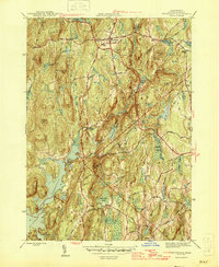
1946 Map of Petersham
USGS Topo · Published 1946About this map
Petersham serves as the central hub of this mid-1940s landscape, situated among a network of hills and water bodies just east of the expansive Quabbin Reservoir. The map illustrates a rural Massachusetts topography defined by significant elevation changes, from Bald Hill and Camels Hump Hill in the north to Potapaug Hill overlooking the reservoir's eastern shore. A complex system of swamps and brooks, including Higgins Swamp and Fever Brook, drains through the undulating terrain toward the Swift River basin.
Find a feature on this map
39 named features on this map. Tap any name to fly to it.
Don’t see what you’re looking for? This feature index may not catch every label — zoom into the map to look around manually.
Map Details
Editions of this 1946 Petersham Map
2 editions found
Other maps of this area

1887 · Warwick
USGS Topo · 1:62,500

1887 · Belchertown
USGS Topo · 1:62,500

1887 · Winchendon
USGS Topo · 1:62,500

1887 · Barre
USGS Topo · 1:62,500

1889 · Barre
USGS Topo · 1:62,500

1889 · Warwick
USGS Topo · 1:62,500

1890 · Belchertown
USGS Topo · 1:62,500

1890 · Winchendon
USGS Topo · 1:62,500

1893 · Belchertown
USGS Topo · 1:62,500

1894 · Winchendon
USGS Topo · 1:62,500