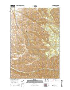
2014 Map of Peterson Ridge
USGS Topo · Published 2014About this map
Peterson Ridge anchors this upland landscape in Umatilla County, where the topography is defined by the deep incisions of the Cottonwood Creek drainage system. The complex network of waterways, including the Middle Fork Cottonwood Cr and South Fork Cottonwood Cr, flows through a series of significant elevations like Goverment Mountain and Saddle Mountain. The southern edge of the survey is dominated by the North Fork Walla Walla River, which carves through the terrain near Blalock Mountain. This area represents a transition into higher elevations, evidenced by landmarks such as Pikes Peak and the settlement of Little Meadows. The presence of established routes like Government Mountain Rd and Birch Creek Rd indicates the vital access points through these steep canyons and timbered ridges, connecting isolated hollows like Pumpkin Hollow to the broader region.
Find a feature on this map
29 named features on this map. Tap any name to fly to it.
Don’t see what you’re looking for? This feature index may not catch every label — zoom into the map to look around manually.
Map Details
Editions of this 2014 Peterson Ridge Map
This is the sole edition of this map. No revisions or reprints were ever made.
Other maps of this area

1919 · Walla Walla
USGS Topo · 1:125,000

1921 · Walla Walla
USGS Topo · 1:125,000

1953 · Pendleton
USGS Topo · 1:250,000

1953 · Walla Walla
USGS Topo · 1:250,000

1956 · Pendleton
USGS Topo · 1:250,000

1958 · Walla Walla
USGS Topo · 1:250,000

1963 · Big Meadows
USGS Topo · 1:24,000

1963 · Tollgate
USGS Topo · 1:24,000

1963 · Blalock Mountain
USGS Topo · 1:24,000

1963 · Peterson Ridge
USGS Topo · 1:24,000