
1963 Map of Big Meadows
USGS Topo · Published 1965About this map
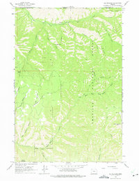
The Umatilla National Forest dominates this mid-century landscape on the border of Walla Walla and Umatilla counties. This 1963 field-checked survey reveals a wilderness defined by its deep drainages and high ridge lines, such as Tiger Ridge and Blalock Mountain. The drainage patterns of the North Fork Walla Walla River and Mill Creek illustrate the challenging terrain of the Blue Mountains, where access was limited to the Government Road and various pack routes like the Government Trail. Significant landmarks such as Big Meadows and the prominent bend known as The Horseshoe provide clear orientation points for researchers tracking old forest service routes or early conservation boundaries. This mapping captures the region before more modern infrastructure penetrated these higher elevations, preserving the original configuration of springs like Russell Spring and remote canyons including Little Meadows Canyon.
Find a feature on this map
24 named features on this map. Tap any name to fly to it.
Don’t see what you’re looking for? This feature index may not catch every label — zoom into the map to look around manually.
Map Details
Editions of this 1963 Big Meadows Map
5 editions found
Other maps of this area

1919 · Walla Walla
USGS Topo · 1:125,000

1921 · Walla Walla
USGS Topo · 1:125,000

1937 · Pomeroy
USGS Topo · 1:96,000

1942 · Pomeroy
USGS Topo · 1:125,000

1953 · Pendleton
USGS Topo · 1:250,000

1953 · Walla Walla
USGS Topo · 1:250,000

1955 · Pullman
USGS Topo · 1:250,000

1955 · Grangeville
USGS Topo · 1:250,000

1956 · Pendleton
USGS Topo · 1:250,000

1958 · Pullman
USGS Topo · 1:250,000