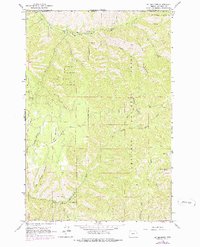
1963 Map of Big Meadows
USGS Topo · Published 1978About this map
Umatilla National Forest dominates this terrain along the Oregon-Washington border, where the steep canyons of the Blue Mountains meet the headwaters of the North Fork Walla Walla River. The landscape is defined by deep drainage systems like Big Meadow Canyon and Henry Canyon, which cut through high ridges such as Broken Ridge and Low Ridge. A solitary Mine located near Mill Creek and the presence of Kiwanis Camp in the northwest corner suggest a history of both resource extraction and seasonal recreation.
Find a feature on this map
29 named features on this map. Tap any name to fly to it.
Don’t see what you’re looking for? This feature index may not catch every label — zoom into the map to look around manually.
Map Details
Editions of this 1963 Big Meadows Map
5 editions found

Other maps of this area

1919 · Walla Walla
USGS Topo · 1:125,000

1921 · Walla Walla
USGS Topo · 1:125,000

1937 · Pomeroy
USGS Topo · 1:96,000

1942 · Pomeroy
USGS Topo · 1:125,000

1953 · Pendleton
USGS Topo · 1:250,000

1953 · Walla Walla
USGS Topo · 1:250,000

1955 · Pullman
USGS Topo · 1:250,000

1955 · Grangeville
USGS Topo · 1:250,000

1956 · Pendleton
USGS Topo · 1:250,000

1958 · Pullman
USGS Topo · 1:250,000