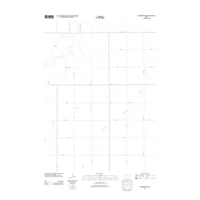
2013 Map of Peterson SW
USGS Topo · Published 2013About this map
Little Sioux River meanders through the northwest corner of this Buena Vista County landscape, where the prairie gives way to the drainage networks of the Maple River and Badger Cr. This 2013 survey illustrates the highly organized agricultural grid typical of northwest Iowa, defined by numbered roads such as 480th St and U Ave. The small community of Maple is positioned at a significant intersection, serving as a local focal point in an otherwise broad expanse of cultivated fields. The presence of Martin Access Rd near the river suggests a point of entry for recreational or utilitarian access to the waterway, contrasting with the strictly rectilinear township and range road system that dominates the rest of the quadrangle.
Find a feature on this map
22 named features on this map. Tap any name to fly to it.
Don’t see what you’re looking for? This feature index may not catch every label — zoom into the map to look around manually.
Map Details
Editions of this 2013 Peterson SW Map
This is the sole edition of this map. No revisions or reprints were ever made.
Other maps of this area

1954 · Fort Dodge
USGS Topo · 1:250,000

1957 · Fort Dodge
USGS Topo · 1:250,000

1958 · Fort Dodge
USGS Topo · 1:250,000

1969 · Aurelia
USGS Topo · 1:24,000

1969 · Cherokee South
USGS Topo · 1:24,000

1971 · Peterson SW
USGS Topo · 1:24,000

1971 · Peterson SE
USGS Topo · 1:24,000
1971 · Peterson
USGS Topo · 1:24,000
1971 · Sutherland West
USGS Topo · 1:24,000
1971 · Sutherland East
USGS Topo · 1:24,000