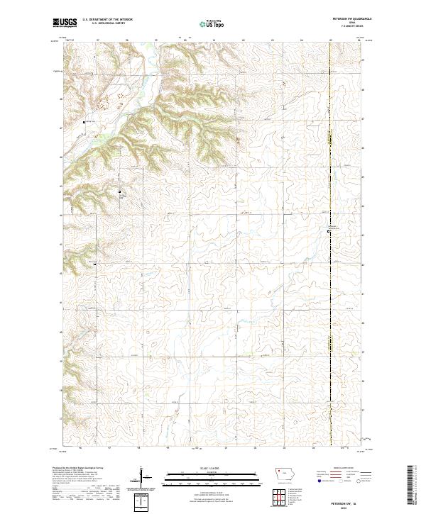
2022 Map of Peterson SW
USGS Topo · Published 2022About this map
The Little Sioux River meanders through the northwest corner of this agricultural landscape on the border of Cherokee and Buena Vista counties. This 2022 survey illustrates the modern rural layout of the region, where the grid of gravel and paved roads like Co Hwy M12 and Co Hwy M10 intersects with the natural drainage of Badger Cr and the Maple River. Local heritage is anchored by several rural burial grounds, including the Spring Township Cem and the Immanuel Lutheran Cem located near the county line. The presence of Martin Access Rd near the river suggests a landscape maintained for both production and conservation. For those tracing family roots in the Iowa countryside, these named landmarks and section lines provide a contemporary baseline of the township's enduring character.
Find a feature on this map
35 named features on this map. Tap any name to fly to it.
Don’t see what you’re looking for? This feature index may not catch every label — zoom into the map to look around manually.
Map Details
Editions of this 2022 Peterson SW Map
This is the sole edition of this map. No revisions or reprints were ever made.
Other maps of this area

1954 · Fort Dodge
USGS Topo · 1:250,000

1957 · Fort Dodge
USGS Topo · 1:250,000

1958 · Fort Dodge
USGS Topo · 1:250,000

1969 · Aurelia
USGS Topo · 1:24,000

1969 · Cherokee South
USGS Topo · 1:24,000

1971 · Peterson SW
USGS Topo · 1:24,000

1971 · Peterson SE
USGS Topo · 1:24,000
1971 · Peterson
USGS Topo · 1:24,000
1971 · Sutherland West
USGS Topo · 1:24,000
1971 · Sutherland East
USGS Topo · 1:24,000