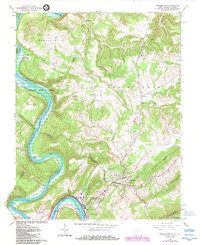
2023 Map of Peterstown
USGS Topo · Published 2023About this map
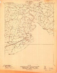
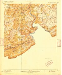
Peterstown sits at the intersection of the regional road network near the winding path of the New River, where the borders of Monroe, Summers, Mercer, and Giles counties meet. The landscape is defined by the sharp ridges of Peters Mountain and Powell Mountain, which channel the flow of the New River and its tributaries like Rich Creek and Stinking Lick Creek. This modern survey reveals a countryside still anchored by its rural hamlets, from Ballard in the north to the industrial river towns of Glen Lyn and Lurich in the south.
Find a feature on this map
131 named features on this map. Tap any name to fly to it.
Don’t see what you’re looking for? This feature index may not catch every label — zoom into the map to look around manually.
Map Details
Editions of this 2023 Peterstown Map
This is the sole edition of this map. No revisions or reprints were ever made.
Historical Maps of Lurich Through Time
5 maps found