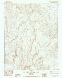
1982 Map of Petroglyph Canyon
USGS Topo · Published 1983About this map
The China Lake Naval Weapons Center dominates this high-desert landscape in the early 1980s, preserving a rugged corridor of the Coso Range. The map reveals a terrain defined by deep volcanic and erosional features, most notably the Petroglyph Canyon and its designated site of Big Petroglyphs, indicating the deep cultural history of the area prior to its modern military use. This area represents a transition between the high mesa of Wild Horse Mesa and the broken canyon systems to the west.
Find a feature on this map
14 named features on this map. Tap any name to fly to it.
Don’t see what you’re looking for? This feature index may not catch every label — zoom into the map to look around manually.
Map Details
Editions of this 1982 Petroglyph Canyon Map
This is the sole edition of this map. No revisions or reprints were ever made.
Other maps of this area

1908 · Ballarat
USGS Topo · 1:250,000

1913 · Ballarat
USGS Topo · 1:250,000

1915 · Searles Lake
USGS Topo · 1:250,000

1947 · Trona
USGS Topo · 1:250,000

1948 · Trona
USGS Topo · 1:250,000

1948 · Death Valley
USGS Topo · 1:250,000

1951 · Haiwee Reservoir
USGS Topo · 1:62,500

1951 · Coso Peak
USGS Topo · 1:62,500

1953 · Mountain Springs Canyon
USGS Topo · 1:62,500

1953 · Trona
USGS Topo · 1:250,000