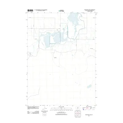
2012 Map of Phantom Lake
USGS Topo · Published 2012About this map
Our Lady of the Lake Cem serves as a lone spiritual landmark in this remote corner of Bennett County, situated along the gentle course of Elm Cr. The landscape is dominated by a complex of managed waterways and wetlands, evidenced by the presence of the Autotour Route Loop and Dike and Hunter Access Rd. These features, along with Refuge Rd, suggest a geography dedicated to conservation and wildlife management centered around the northern water bodies. Further south, the namesake Phantom Lake sits in a more isolated portion of the plains, connected by a network of section-line roads like Tuthill-Eli Rd and Cedar Creek Rd. The drainage patterns of Lake Cr and Cedar Cr define the western reaches, illustrating the hydrological character of this High Plains environment.
Find a feature on this map
17 named features on this map. Tap any name to fly to it.
Don’t see what you’re looking for? This feature index may not catch every label — zoom into the map to look around manually.
Map Details
Editions of this 2012 Phantom Lake Map
This is the sole edition of this map. No revisions or reprints were ever made.
Other maps of this area

1951 · Merriman
USGS Topo · 1:62,500

1952 · Eli
USGS Topo · 1:62,500

1955 · Martin
USGS Topo · 1:250,000

1957 · Valentine
USGS Topo · 1:250,000

1958 · Martin
USGS Topo · 1:250,000

1959 · Valentine
USGS Topo · 1:250,000

1981 · Phantom Lake
USGS Topo · 1:25,000

1981 · Martin
USGS Topo · 1:25,000

1981 · Scotchman Lake
USGS Topo · 1:25,000

1981 · Tuthill
USGS Topo · 1:25,000