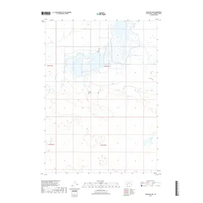
2017 Map of Phantom Lake
USGS Topo · Published 2017About this map
Our Lady of the Lake Cem serves as a central landmark in this portion of Bennett County, situated just north of Hwy 18. The landscape is defined by its complex hydrology, with the namesake Phantom Lake positioned in the southeast and a network of drainages including Lake Cr, Cedar Cr, and Elm Cr flowing through the northern sections. This 2017 survey reflects the sparse, rural nature of the South Dakota plains, where the land is organized by section lines and remote connecting routes like Tuthill-Eli Rd. The presence of small local names such as Bird Walk and Oriole Ln suggests localized residential or recreational pockets within the broader agricultural and open terrain. The topography reveals the subtle but important elevation changes typical of this region, impacting how water moves toward the various creeks and lake basins.
Find a feature on this map
14 named features on this map. Tap any name to fly to it.
Don’t see what you’re looking for? This feature index may not catch every label — zoom into the map to look around manually.
Map Details
Editions of this 2017 Phantom Lake Map
This is the sole edition of this map. No revisions or reprints were ever made.
Other maps of this area

1951 · Merriman
USGS Topo · 1:62,500

1952 · Eli
USGS Topo · 1:62,500

1955 · Martin
USGS Topo · 1:250,000

1957 · Valentine
USGS Topo · 1:250,000

1958 · Martin
USGS Topo · 1:250,000

1959 · Valentine
USGS Topo · 1:250,000

1981 · Phantom Lake
USGS Topo · 1:25,000

1981 · Martin
USGS Topo · 1:25,000

1981 · Scotchman Lake
USGS Topo · 1:25,000

1981 · Tuthill
USGS Topo · 1:25,000