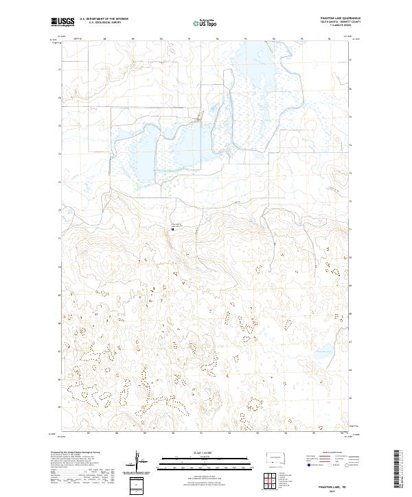
2021 Map of Phantom Lake
USGS Topo · Published 2021About this map
Lake Creek and its broad, marshy basin dominate this portion of the northern Great Plains, creating a complex wetland environment in Bennett County. The drainage network is further defined by Elm Cr in the central portion of the quadrangle and the namesake Phantom Lake near the southeastern corner. This landscape reflects the sparse, rural nature of the South Dakota prairie, where life centers around the primary corridor of Hwy 18. Historically significant sites for local families and genealogists include Our Lady of the Lake Cem, which stands near the intersection of the highway and Oridle Ln. Local travel is facilitated by a network of secondary routes such as Tuthill-Eli Rd and Eli Rd, tracing paths through the open terrain between the major creek beds.
Find a feature on this map
13 named features on this map. Tap any name to fly to it.
Don’t see what you’re looking for? This feature index may not catch every label — zoom into the map to look around manually.
Map Details
Editions of this 2021 Phantom Lake Map
This is the sole edition of this map. No revisions or reprints were ever made.
Other maps of this area

1951 · Merriman
USGS Topo · 1:62,500

1952 · Eli
USGS Topo · 1:62,500

1955 · Martin
USGS Topo · 1:250,000

1957 · Valentine
USGS Topo · 1:250,000

1958 · Martin
USGS Topo · 1:250,000

1959 · Valentine
USGS Topo · 1:250,000

1981 · Phantom Lake
USGS Topo · 1:25,000

1981 · Martin
USGS Topo · 1:25,000

1981 · Scotchman Lake
USGS Topo · 1:25,000

1981 · Tuthill
USGS Topo · 1:25,000