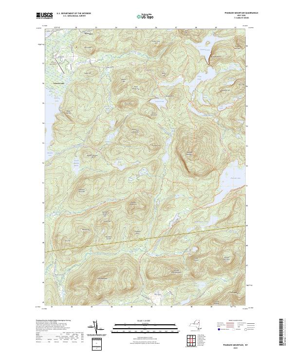
2023 Map of Pharaoh Mountain
USGS Topo · Published 2023About this map
Pharaoh Mountain dominates this landscape, rising above a network of high-altitude ponds and marshes that define the eastern Adirondacks. The map records the intricate waterways of the region, from the wide expanse of Schroon Lake to smaller, isolated bodies of water like Spectacle Pond and Whortleberry Pond. These features are connected by an extensive system of wilderness routes, including the Pharaoh Lake Trl and the Glidden Marsh to Pharaoh Lake Trl, which suggest a terrain shaped by recreation and forestry rather than dense settlement.
Find a feature on this map
98 named features on this map. Tap any name to fly to it.
Don’t see what you’re looking for? This feature index may not catch every label — zoom into the map to look around manually.
Map Details
Editions of this 2023 Pharaoh Mountain Map
This is the sole edition of this map. No revisions or reprints were ever made.
Other maps of this area

1895 · North Creek
USGS Topo · 1:62,500

1895 · Paradox Lake
USGS Topo · 1:62,500

1897 · Bolton
USGS Topo · 1:62,500

1897 · Paradox Lake
USGS Topo · 1:62,500

1897 · North Creek
USGS Topo · 1:62,500

1897 · Schroon Lake
USGS Topo · 1:62,500

1900 · Bolton
USGS Topo · 1:62,500

1950 · Glens Falls
USGS Topo · 1:250,000
1953 · Paradox Lake
USGS Topo · 1:62,500

1953 · Schroon Lake
USGS Topo · 1:62,500