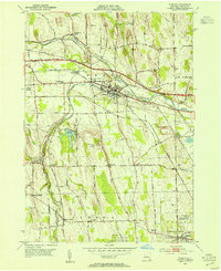
1953 Map of Phelps
USGS Topo · Published 1954About this map
Phelps serves as the central hub of this mid-century Ontario County landscape, where the Canandaigua Outlet and Flint Creek converge. The era’s industrial and transit priorities are clear, with the New York State Thruway cutting across the northern half while traditional rail lines like the New York Central and Lehigh Valley still define local geography. Significant land use is dedicated to research at the State Agricultural Experiment Station in the south, reflecting the region's agricultural importance. Genealogists will find a wealth of family history sites, from the numerous small burial grounds like Westfall Cem and Whitney Cem to established rural communities such as Seneca Castle, Oaks Corners, and Orleans. The map also captures infrastructure of the television age with the Television Relay Sta and local water management at the Newark Reservoir.
Find a feature on this map
40 named features on this map. Tap any name to fly to it.
Don’t see what you’re looking for? This feature index may not catch every label — zoom into the map to look around manually.
Map Details
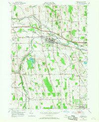
Editions of this 1953 Phelps Map
2 editions found
Other maps of this area

1899 · Palmyra
USGS Topo · 1:62,500

1902 · Geneva
USGS Topo · 1:62,500

1902 · Clyde
USGS Topo · 1:62,500

1902 · Phelps
USGS Topo · 1:62,500

1902 · Palmyra
USGS Topo · 1:62,500

1942 · Rushville
USGS Topo · 1:31,680

1942 · Stanley
USGS Topo · 1:31,680

1943 · Lyons
USGS Topo · 1:31,680

1943 · Geneva North
USGS Topo · 1:31,680

1943 · Geneva South
USGS Topo · 1:31,680