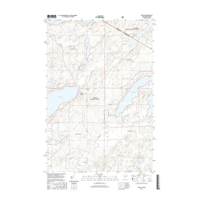
2015 Map of Phelps
USGS Topo · Published 2015About this map
Phelps sits as the central settlement in this Northwoods landscape, situated near the shores of North Twin Lake and Noseeum Lake. The area is characterized by a dense network of glacial lakes and waterways, including the expansive Lac Vieux Desert on the northern border, which straddles the line between Michigan and Wisconsin. The terrain is marked by significant features like Military Hill and is largely encompassed by the Ottawa National Forest and Nicolet National Forest.
Find a feature on this map
62 named features on this map. Tap any name to fly to it.
Don’t see what you’re looking for? This feature index may not catch every label — zoom into the map to look around manually.
Map Details
Editions of this 2015 Phelps Map
This is the sole edition of this map. No revisions or reprints were ever made.
Other maps of this area

1928 · Three Lakes
USGS Topo · 1:48,000

1938 · Phelps
USGS Topo · 1:48,000

1938 · Alvin
USGS Topo · 1:48,000

1938 · Three Lakes
USGS Topo · 1:48,000

1945 · Three Lakes
USGS Topo · 1:48,000

1946 · Alvin
USGS Topo · 1:48,000

1950 · Phelps
USGS Topo · 1:48,000

1954 · Iron Mountain
USGS Topo · 1:250,000

1956 · Beechwood
USGS Topo · 1:62,500

1956 · Phelps
USGS Topo · 1:62,500