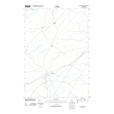
2010 Map of Philadelphia
USGS Topo · Published 2010About this map
The Indian River winds through the village of Philadelphia, where the settlement's layout reflects a long history of water-powered industry and regional transit in Jefferson County. This landscape is defined by its numerous family-named junctions, including Bishops Corners, Bentleys Corners, Halls Corner, and Shurtleff Corners, which trace the historical rural road network of Wilna. These small crossroads and local landmarks offer a detailed look at the agricultural and residential development of the early 21st century.
Find a feature on this map
13 named features on this map. Tap any name to fly to it.
Don’t see what you’re looking for? This feature index may not catch every label — zoom into the map to look around manually.
Map Details
Editions of this 2010 Philadelphia Map
This is the sole edition of this map. No revisions or reprints were ever made.
Other maps of this area

1903 · Alexandria Bay
USGS Topo · 1:62,500

1903 · Theresa
USGS Topo · 1:62,500

1911 · Antwerp
USGS Topo · 1:62,500

1912 · Hammond
USGS Topo · 1:62,500

1943 · Redwood
USGS Topo · 1:31,680

1944 · Hammond
USGS Topo · 1:62,500

1948 · Theresa
USGS Topo · 1:24,000
1948 · Black River
USGS Topo · 1:24,000
1948 · Theresa
USGS Topo · 1:62,500

1948 · Alexandria Bay
USGS Topo · 1:62,500