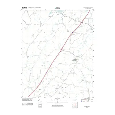
2010 Map of Philadelphia
USGS Topo · Published 2010About this map
Philadelphia serves as the central hub of this eastern Tennessee landscape, where modern transportation corridors intersect with a deep agricultural and industrial heritage. The settlement is anchored by the Philadelphia Post Office, while the surrounding terrain is defined by prominent ridges like Snow Ridge, Matlock Ridge, and Watson Ridge. The map documents a significant mining history in the southern section, specifically noting the Preston Mine, McGuire Mine, and Vida Mine, which highlight the area's geological resources.
Find a feature on this map
75 named features on this map. Tap any name to fly to it.
Don’t see what you’re looking for? This feature index may not catch every label — zoom into the map to look around manually.
Map Details
Editions of this 2010 Philadelphia Map
This is the sole edition of this map. No revisions or reprints were ever made.
Other maps of this area

1887 · Kingston
USGS Topo · 1:125,000

1891 · Kingston
USGS Topo · 1:125,000

1893 · Kingston
USGS Topo · 1:125,000

1895 · Loudon
USGS Topo · 1:125,000

1935 · Niota
USGS Topo · 1:24,000

1935 · Lenoir City
USGS Topo · 1:24,000

1935 · Philadelphia
USGS Topo · 1:24,000

1936 · Cave Creek
USGS Topo · 1:24,000
1936 · Madisonville
USGS Topo · 1:24,000
1936 · Sweetwater
USGS Topo · 1:24,000