1952 Map of Philadelphia
USGS Topo · Published 1954About this map
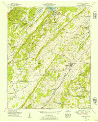
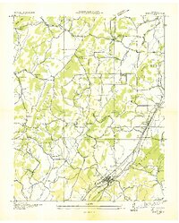
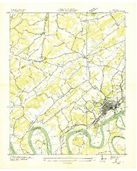
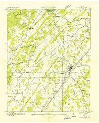
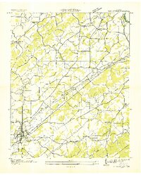
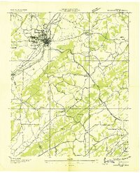
Philadelphia serves as a primary hub of activity in this Tennessee valley landscape, situated where the Southern railroad and the Lee Highway parallel one another through the terrain. The map captures a moment of established rural infrastructure, with small communities like Adolphus anchored by essential social markers like the Snow School and Stockton Valley Church. To the north, the waters of Watts Bar Lake and the Tennessee R indicate the transformative impact of mid-century river management on the regional geography.
Find a feature on this map
47 named features on this map. Tap any name to fly to it.
Don’t see what you’re looking for? This feature index may not catch every label — zoom into the map to look around manually.
Map Details
Editions of this 1952 Philadelphia Map
This is the sole edition of this map. No revisions or reprints were ever made.
Other maps of this area

1887 · Kingston
USGS Topo · 1:125,000

1891 · Kingston
USGS Topo · 1:125,000

1893 · Kingston
USGS Topo · 1:125,000

1895 · Loudon
USGS Topo · 1:125,000
1935 · Niota
USGS Topo · 1:24,000
1935 · Lenoir City
USGS Topo · 1:24,000
1935 · Philadelphia
USGS Topo · 1:24,000

1936 · Cave Creek
USGS Topo · 1:24,000
1936 · Madisonville
USGS Topo · 1:24,000
1936 · Sweetwater
USGS Topo · 1:24,000