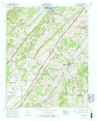
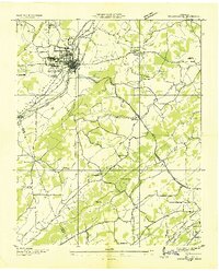
1974 Map of Philadelphia
USGS Topo · Published 1977About this map
The Southern Railway corridor serves as the industrial and social spine of this East Tennessee landscape, connecting the town of Philadelphia to the northern edge of Fairlane. The terrain is defined by the parallel ridges of Snow Ridge, Matlock Ridge, and Black Oak Ridge, which channel the flow of the Stockton Valley Creek and Sweetwater Creek. This 1974 revision captures the area’s agricultural character through numerous rural landmarks like Old Sweetwater Cem, Tompson Cem, and Stockton Valley Church. In the northwest, the map reaches the waters of Watts Bar Lake and the Watts Bar Reservation, illustrating the intersection of historic valley farming with mid-century hydroelectric infrastructure. The transition from high ridges to fertile creek valleys is further marked by the proximity of Loudon City Park and several family-named landmarks like Galyon Gap and Roberson Cem.
Find a feature on this map
42 named features on this map. Tap any name to fly to it.
Don’t see what you’re looking for? This feature index may not catch every label — zoom into the map to look around manually.
Map Details
Editions of this 1974 Philadelphia Map
This is the sole edition of this map. No revisions or reprints were ever made.
Other maps of this area

1887 · Kingston
USGS Topo · 1:125,000

1891 · Kingston
USGS Topo · 1:125,000

1893 · Kingston
USGS Topo · 1:125,000

1895 · Loudon
USGS Topo · 1:125,000
1935 · Niota
USGS Topo · 1:24,000
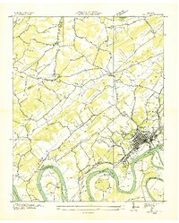
1935 · Lenoir City
USGS Topo · 1:24,000
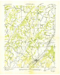
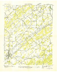
1935 · Philadelphia
USGS Topo · 1:24,000

1936 · Cave Creek
USGS Topo · 1:24,000
1936 · Madisonville
USGS Topo · 1:24,000
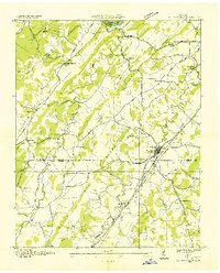
1936 · Sweetwater
USGS Topo · 1:24,000