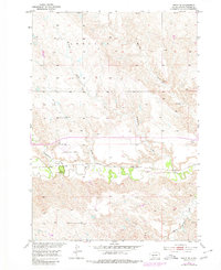
1953 Map of Philip SE
USGS Topo · Published 1980About this map
The Chicago and North Western railroad corridor defines the central landscape of this South Dakota survey, tracing a path parallel to the meandering Bad River. This transport artery connects the settlement of Powell to the regional infrastructure, reflecting the importance of rail logistics for the ranching and agricultural interests of Haakon County. Aviation history is also represented near the western edge by the Philip Municipal Airport and its associated Beacon, serving as a navigational waypoint in a territory marked by complex drainage systems.
Find a feature on this map
13 named features on this map. Tap any name to fly to it.
Don’t see what you’re looking for? This feature index may not catch every label — zoom into the map to look around manually.
Map Details
Editions of this 1953 Philip SE Map
2 editions found
Other maps of this area

1953 · Philip Junction
USGS Topo · 1:24,000

1953 · Philip
USGS Topo · 1:24,000

1953 · Philip SE
USGS Topo · 1:24,000

1954 · Belvidere NW
USGS Topo · 1:24,000

1954 · Kadoka NE
USGS Topo · 1:24,000

1954 · Powell
USGS Topo · 1:24,000

1954 · Pierre
USGS Topo · 1:250,000

1955 · Martin
USGS Topo · 1:250,000

1958 · Pierre
USGS Topo · 1:250,000

1958 · Martin
USGS Topo · 1:250,000