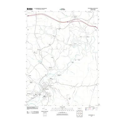
2010 Map of Philipsburg
USGS Topo · Published 2010About this map
Moshannon Creek anchors this central Pennsylvania landscape, winding between coal-country settlements and industrial sites. The borough of Philipsburg serves as a primary hub, surrounded by a constellation of smaller communities including Chester Hill, South Philipsburg, and North Philipsburg. Evidence of the region's mining heritage is prominent through labels like Rusnak Mine and Cuba Mines, while local genealogy is well-supported by numerous burial grounds such as Kylertown Cemetery, Hunter Cemetery, and the Immanuel Cemetery near Winburne.
Find a feature on this map
89 named features on this map. Tap any name to fly to it.
Don’t see what you’re looking for? This feature index may not catch every label — zoom into the map to look around manually.
Map Details
Editions of this 2010 Philipsburg Map
This is the sole edition of this map. No revisions or reprints were ever made.
Other maps of this area

1903 · Houtzdale
USGS Topo · 1:62,500

1905 · Houtzdale
USGS Topo · 1:62,500

1922 · Philipsburg
USGS Topo · 1:62,500

1929 · Karthaus
USGS Topo · 1:62,500

1929 · Clearfield
USGS Topo · 1:48,000

1932 · Clearfield
USGS Topo · 1:62,500

1932 · Karthaus
USGS Topo · 1:62,500

1939 · Philipsburg
USGS Topo · 1:62,500

1944 · Houtzdale
USGS Topo · 1:24,000

1945 · Philipsburg
USGS Topo · 1:62,500