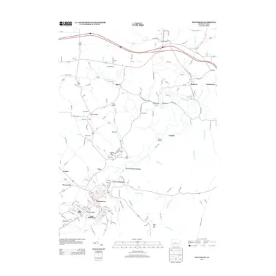
2013 Map of Philipsburg
USGS Topo · Published 2013About this map
Philipsburg and its surrounding borough-heavy landscape are defined by a complex network of residential clusters and historical industrial sites. The southern half of the map reveals a dense settlement pattern where South Philipsburg, Chester Hill, and North Philipsburg converge near the winding path of Cold Stream. This area is historically marked by the Cuba Mines, illustrating the region's long-standing connection to coal extraction.
Find a feature on this map
167 named features on this map. Tap any name to fly to it.
Don’t see what you’re looking for? This feature index may not catch every label — zoom into the map to look around manually.
Map Details
Editions of this 2013 Philipsburg Map
This is the sole edition of this map. No revisions or reprints were ever made.
Other maps of this area

1903 · Houtzdale
USGS Topo · 1:62,500

1905 · Houtzdale
USGS Topo · 1:62,500

1922 · Philipsburg
USGS Topo · 1:62,500

1929 · Karthaus
USGS Topo · 1:62,500

1929 · Clearfield
USGS Topo · 1:48,000

1932 · Clearfield
USGS Topo · 1:62,500

1932 · Karthaus
USGS Topo · 1:62,500

1939 · Philipsburg
USGS Topo · 1:62,500

1944 · Houtzdale
USGS Topo · 1:24,000

1945 · Philipsburg
USGS Topo · 1:62,500