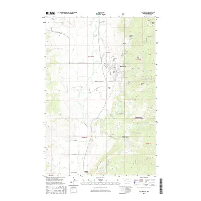
2017 Map of Philipsburg
USGS Topo · Published 2017About this map
Philipsburg sits at the heart of this Western Montana landscape, where the Philipsburg Valley meets the rising terrain of the Deerlodge National Forest. This 2017 study illustrates the town's position relative to its historic mining and ranching surroundings, showing the established grid of streets like W Sutter St and E Broadway St, along with the Philipsburg Cem and the local airstrip at Riddick Field.
Find a feature on this map
73 named features on this map. Tap any name to fly to it.
Don’t see what you’re looking for? This feature index may not catch every label — zoom into the map to look around manually.
Map Details
Editions of this 2017 Philipsburg Map
This is the sole edition of this map. No revisions or reprints were ever made.
Other maps of this area

1908 · Philipsburg
USGS Topo · 1:125,000

1947 · Butte
USGS Topo · 1:250,000

1958 · Butte
USGS Topo · 1:250,000

1960 · Butte
USGS Topo · 1:250,000

1962 · Butte
USGS Topo · 1:250,000

1971 · Henderson Mountain
USGS Topo · 1:24,000

1971 · Georgetown Lake
USGS Topo · 1:24,000
1971 · Maxville
USGS Topo · 1:24,000

1971 · Antelope Creek
USGS Topo · 1:24,000

1971 · Potato Lakes
USGS Topo · 1:24,000