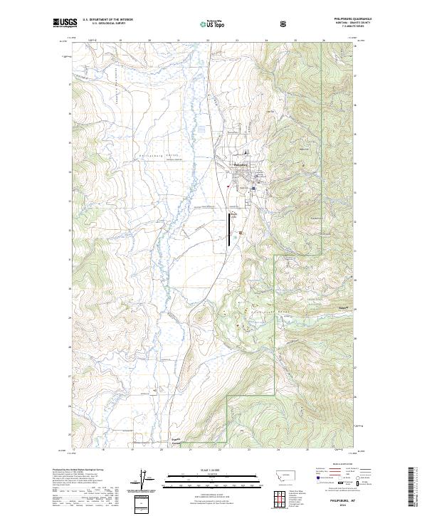
2024 Map of Philipsburg
USGS Topo · Published 2024About this map
Philipsburg sits at the eastern edge of the Philipsburg Valley, serving as the gateway to the mineral-rich heights of the Flint Creek Range and the Deerlodge National Forest. This 2024 survey captures the historic county seat, including the Granite County Courthouse and Philipsburg Cem, centered among a complex terrain of gulches and hills. The landscape reflects a legacy of extraction and infrastructure, from the industrial imprint near Rumsey to the water-management systems of the Marshall Creek Canal.
Find a feature on this map
84 named features on this map. Tap any name to fly to it.
Don’t see what you’re looking for? This feature index may not catch every label — zoom into the map to look around manually.
Map Details
Editions of this 2024 Philipsburg Map
This is the sole edition of this map. No revisions or reprints were ever made.
Other maps of this area

1908 · Philipsburg
USGS Topo · 1:125,000

1947 · Butte
USGS Topo · 1:250,000

1958 · Butte
USGS Topo · 1:250,000

1960 · Butte
USGS Topo · 1:250,000

1962 · Butte
USGS Topo · 1:250,000

1971 · Henderson Mountain
USGS Topo · 1:24,000

1971 · Georgetown Lake
USGS Topo · 1:24,000
1971 · Maxville
USGS Topo · 1:24,000

1971 · Antelope Creek
USGS Topo · 1:24,000

1971 · Potato Lakes
USGS Topo · 1:24,000