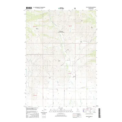
2017 Map of Phillips Creek
USGS Topo · Published 2017About this map
Sawtooth National Forest dominates the northern reaches of this Idaho landscape, where the Soldier Mountains rise above a complex network of drainages. The terrain is defined by dramatic elevation shifts, transitioning from the high ridges of Elk Ridge and Wells Summit down into prominent incisions like Edwards Gulch and Brush Canyon. Water defines the geography here, with Soldier Creek serving as a central artery, fed by numerous tributaries including Free Gold Creek and Bridge Creek.
Find a feature on this map
50 named features on this map. Tap any name to fly to it.
Don’t see what you’re looking for? This feature index may not catch every label — zoom into the map to look around manually.
Map Details
Editions of this 2017 Phillips Creek Map
This is the sole edition of this map. No revisions or reprints were ever made.
Other maps of this area

1900 · Sawtooth
USGS Topo · 1:125,000

1955 · Hailey
USGS Topo · 1:250,000

1957 · Fairfield
USGS Topo · 1:62,500

1957 · Blaine
USGS Topo · 1:62,500

1959 · Hailey
USGS Topo · 1:250,000

1962 · Hailey
USGS Topo · 1:250,000

1970 · Sydney Butte
USGS Topo · 1:24,000

1970 · Dollarhide Mtn
USGS Topo · 1:24,000
1970 · Boardman Creek
USGS Topo · 1:24,000
1986 · Phillips
USGS Topo · 1:24,000