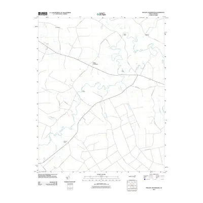
2010 Map of Phillips Crossroads
USGS Topo · Published 2010About this map
The Trent River meanders across this Jones County landscape, defining the character of the coastal plain as it was documented in 2010. Spanning the river at strategic intervals are the historic crossing points of Wilcox Bridge, Perry Bridge, and Free Bridge, which serve as critical nodes in a rural network of named roads like Chinquapin Chapel Rd and Country Rd. Small agricultural settlements including Phillips Crossroads and Chinquapin anchor the intersections, surrounded by a complex system of local drainage features such as Pocoson Branch and Cypress Creek. The transition from larger county routes to farm-to-market lanes reveals the enduring agrarian pattern of the region. Local researchers will find interest in the specific named branches and runs, such as Mill Branch and Crooked Run, which historically dictated the placement of homesteads and tobacco fields throughout this part of eastern North Carolina.
Find a feature on this map
39 named features on this map. Tap any name to fly to it.
Don’t see what you’re looking for? This feature index may not catch every label — zoom into the map to look around manually.
Map Details
Editions of this 2010 Phillips Crossroads Map
This is the sole edition of this map. No revisions or reprints were ever made.
Other maps of this area

1903 · Trent River
USGS Topo · 1:62,500

1904 · Trent River
USGS Topo · 1:62,500

1943 · Jacksonville
USGS Topo · 1:62,500

1948 · Richlands
USGS Topo · 1:62,500

1953 · Rocky Mount
USGS Topo · 1:250,000

1953 · Beaufort
USGS Topo · 1:250,000

1954 · Rocky Mount
USGS Topo · 1:250,000

1954 · Beaufort
USGS Topo · 1:250,000

1958 · Deep Run
USGS Topo · 1:62,500

1965 · Richlands
USGS Topo · 1:62,500