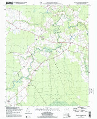
1997 Map of Phillips Crossroads
USGS Topo · Published 2001About this map
The Trent River meanders through this Jones County landscape, defining a region where dense wetlands and traditional rural settlements meet. To the south, the expansive White Oak Pocosin and the managed timberlands of the Hofmann Forest dominate the terrain, illustrating the coastal plain's characteristic boggy environment. This 1997 photo-inspection records a network of small communities and family-named landmarks, such as Phillips Crossroads and Pollocks, that have long anchored this agricultural and timber-producing area.
Find a feature on this map
27 named features on this map. Tap any name to fly to it.
Don’t see what you’re looking for? This feature index may not catch every label — zoom into the map to look around manually.
Map Details
Editions of this 1997 Phillips Crossroads Map
This is the sole edition of this map. No revisions or reprints were ever made.
Other maps of this area

1903 · Trent River
USGS Topo · 1:62,500

1904 · Trent River
USGS Topo · 1:62,500

1943 · Jacksonville
USGS Topo · 1:62,500

1948 · Richlands
USGS Topo · 1:62,500

1953 · Rocky Mount
USGS Topo · 1:250,000

1953 · Beaufort
USGS Topo · 1:250,000

1954 · Rocky Mount
USGS Topo · 1:250,000

1954 · Beaufort
USGS Topo · 1:250,000

1958 · Deep Run
USGS Topo · 1:62,500

1965 · Richlands
USGS Topo · 1:62,500