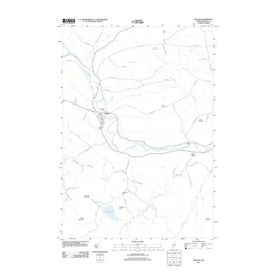
2011 Map of Phillips
USGS Topo · Published 2011About this map
Phillips serves as the focal point of this western Maine landscape, situated along a sharp bend in the Sandy River. The town layout reveals a concentrated center of local history, including the Phillips Post Office and several burial grounds such as Riverside Cemetery, Evergreen Cemetery, and the Phillips-Maine Cemetery. Southward, the terrain transitions into the high peaks of the region, defined by Tantrattle Mountain, Phillips Mountain, and Day Mountain, which frame the valley of Mount Blue Stream.
Find a feature on this map
67 named features on this map. Tap any name to fly to it.
Don’t see what you’re looking for? This feature index may not catch every label — zoom into the map to look around manually.
Map Details
Editions of this 2011 Phillips Map
This is the sole edition of this map. No revisions or reprints were ever made.
Other maps of this area

1924 · Farmington
USGS Topo · 1:62,500

1926 · Dixfield
USGS Topo · 1:62,500

1929 · Phillips
USGS Topo · 1:48,000

1929 · Dixfield
USGS Topo · 1:62,500

1930 · Kingfield
USGS Topo · 1:48,000

1932 · Phillips
USGS Topo · 1:62,500

1932 · Kingfield
USGS Topo · 1:62,500

1950 · Lewiston
USGS Topo · 1:250,000

1956 · Dixfield
USGS Topo · 1:48,000

1956 · Farmington
USGS Topo · 1:62,500