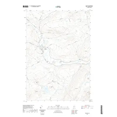
2021 Map of Phillips
USGS Topo · Published 2021About this map
Phillips serves as the focal point of this 2021 survey, situated along the banks of the Sandy River where it meets numerous smaller tributaries. The settlement pattern is defined by its relationship to the water and the surrounding peaks, including Phillips Mtn and Tantrattle Mtn. This area in Franklin County contains a high density of small family and community burial grounds, such as the Knott Burial Plot, Sand Hill Cem, and the Sprague-Howland Cem, which offer significant value for genealogical research in this part of Maine. Beyond the village centers of Phillips and Avon, the landscape is dominated by high elevations like Spruce Mtn and Tory Hill, with Lindbergh Airport providing a modern transportation link amidst the traditional New England terrain. The drainage network, featuring Mount Blue Stream and Bean Brook, illustrates the complex hydrology that historically supported local agriculture and industry.
Find a feature on this map
72 named features on this map. Tap any name to fly to it.
Don’t see what you’re looking for? This feature index may not catch every label — zoom into the map to look around manually.
Map Details
Editions of this 2021 Phillips Map
This is the sole edition of this map. No revisions or reprints were ever made.
Other maps of this area

1924 · Farmington
USGS Topo · 1:62,500

1926 · Dixfield
USGS Topo · 1:62,500

1929 · Phillips
USGS Topo · 1:48,000

1929 · Dixfield
USGS Topo · 1:62,500

1930 · Kingfield
USGS Topo · 1:48,000

1932 · Phillips
USGS Topo · 1:62,500

1932 · Kingfield
USGS Topo · 1:62,500

1950 · Lewiston
USGS Topo · 1:250,000

1956 · Dixfield
USGS Topo · 1:48,000

1956 · Farmington
USGS Topo · 1:62,500