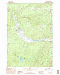
1984 Map of Phillips
USGS Topo · Published 1985About this map
The Sandy River winds through this mid-1980s landscape, serving as the central artery for the settlements of Phillips and Avon. The terrain is defined by prominent peaks such as Tantrattle Mtn and Phillips Mtn, while smaller family-named landmarks like Sampson Hill and Sylvester Hill dot the countryside. This topographic study captures a moment when the regional transport history is still visible on the land, most notably through the Old Railroad Grade that follows the river corridor, a remnant of the narrow-gauge rail systems that once served the Maine woods.
Find a feature on this map
33 named features on this map. Tap any name to fly to it.
Don’t see what you’re looking for? This feature index may not catch every label — zoom into the map to look around manually.
Map Details
Editions of this 1984 Phillips Map
This is the sole edition of this map. No revisions or reprints were ever made.
Other maps of this area

1924 · Farmington
USGS Topo · 1:62,500

1926 · Dixfield
USGS Topo · 1:62,500

1929 · Phillips
USGS Topo · 1:48,000

1929 · Dixfield
USGS Topo · 1:62,500

1930 · Kingfield
USGS Topo · 1:48,000

1932 · Phillips
USGS Topo · 1:62,500

1932 · Kingfield
USGS Topo · 1:62,500

1950 · Lewiston
USGS Topo · 1:250,000

1956 · Dixfield
USGS Topo · 1:48,000

1956 · Farmington
USGS Topo · 1:62,500