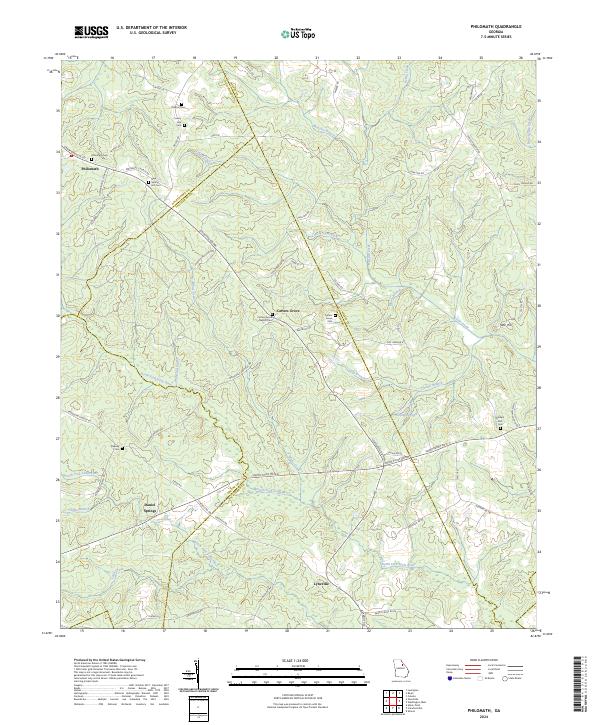
2024 Map of Philomath
USGS Topo · Published 2024About this map
Philomath and the surrounding rural landscape of Oglethorpe and Wilkes counties are defined by a network of historic family-named cemeteries and quiet watercourses. This area, which includes the small settlements of Lyneville, Carters Grove, and Daniel Springs, is anchored by its agricultural roots and church communities. Significant genealogy resources are present throughout the sheet, including the Carters Grove Baptist Cem, Phillips Mill Cem, and Beasley Cem.
Find a feature on this map
78 named features on this map. Tap any name to fly to it.
Don’t see what you’re looking for? This feature index may not catch every label — zoom into the map to look around manually.
Map Details
Editions of this 2024 Philomath Map
This is the sole edition of this map. No revisions or reprints were ever made.
Other maps of this area

1906 · Crawfordville
USGS Topo · 1:125,000

1953 · Athens
USGS Topo · 1:250,000

1958 · Athens
USGS Topo · 1:250,000

1959 · Athens
USGS Topo · 1:250,000

1963 · Athens
USGS Topo · 1:250,000

1965 · Woodville
USGS Topo · 1:24,000

1965 · Union Point
USGS Topo · 1:24,000

1966 · Philomath
USGS Topo · 1:24,000

1966 · Crawfordville
USGS Topo · 1:24,000
1971 · Lexington
USGS Topo · 1:24,000