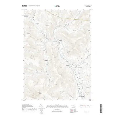
2019 Map of Phoenicia
USGS Topo · Published 2019About this map
Esopus Creek carves a deep valley through the high peaks of the Catskills, serving as the primary corridor for settlements like Phoenicia and Mount Pleasant. This 2019 survey captures the rugged topography where steep-sided massifs such as Tremper Mtn and Romer Mtn hem in narrow hollows. The map illustrates how human habitation follows the water, with hamlets like Chichester and Allaben established along the valley floor. Genealogists will find significant value in the distribution of family and community burial grounds, including the Shandaken Rural Cem and Hudler Cem, which remain as markers of the area's long-settled history. The landscape is defined by its drainage patterns, with Stony Clove Creek and Woodland Creek feeding into the main Esopus channel, highlighting the traditional mountain-valley economy of the region.
Find a feature on this map
90 named features on this map. Tap any name to fly to it.
Don’t see what you’re looking for? This feature index may not catch every label — zoom into the map to look around manually.
Map Details
Editions of this 2019 Phoenicia Map
This is the sole edition of this map. No revisions or reprints were ever made.
Other maps of this area

1892 · Kaaterskill
USGS Topo · 1:62,500

1893 · Kaaterskill
USGS Topo · 1:62,500

1894 · Kaaterskill
USGS Topo · 1:62,500

1899 · Kaaterskill
USGS Topo · 1:62,500

1900 · Phoenicia
USGS Topo · 1:62,500

1901 · Rosendale
USGS Topo · 1:62,500

1903 · Rosendale
USGS Topo · 1:62,500

1903 · Phoenicia
USGS Topo · 1:62,500

1903 · Kaaterskill
USGS Topo · 1:62,500

1903 · Slide Mountain
USGS Topo · 1:62,500