2023 Map of Phoenicia
USGS Topo · Published 2023About this map
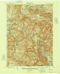
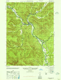
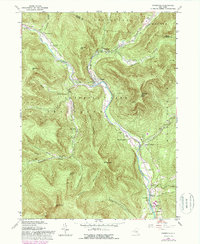
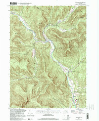
Phoenicia sits at the heart of this mountain landscape where Stony Clove Creek meets Esopus Creek, a natural confluence that shaped the area's historic settlements and early road networks. The terrain is dominated by high peaks of the Burroughs Range, including Wittenberg Mountain and Cornell Mountain, which overlook deep valleys like Traver Hollow and Silver Hollow. For genealogists and local historians, the map provides precise locations for several burial grounds, such as Lanesville Cem in the north and Longyear Cem near Mount Pleasant. The proximity of places like Chichester, Allaben, and Mount Tremper reflects the settlement patterns that followed these river corridors. From the southern reaches near Boiceville to the high ridges of Sheridan Mountain, the map documents the established infrastructure of the Catskills.
Find a feature on this map
93 named features on this map. Tap any name to fly to it.
Don’t see what you’re looking for? This feature index may not catch every label — zoom into the map to look around manually.
Map Details
Editions of this 2023 Phoenicia Map
This is the sole edition of this map. No revisions or reprints were ever made.
Historical Maps of Allaben Through Time
6 maps found